The Far North, between myth and reality
Immaculate white landscapes, both wild and inhabited, land that is far from any claim on it… Clichés and inaccuracies about the Arctic abound. Escales untangle the true from the false.
“There are only white landscapes in the Arctic”… false!
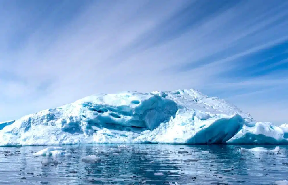
The Arctic is a gigantic land, extending from tundras and taigas to the North Pole. But the Arctic is also a sea — the Arctic Ocean — surrounded by the mainland. This particularity produces atmospheric exchanges and strong ocean currents and therefore great biodiversity, especially for flora. For example, there is pollen in the centre of Greenland’s ice cap. Moreover, PONANT cruises go to Greenland during the season when there is an enormous number of flowers. Remember that this is a very rich land: wheat is grown here! For example, you can go to the south of Greenland to see the wildflowers in bloom in July and the autumn colours in August. If you want to be surrounded by ice, Spitsbergen is the place for you. The west coast of Greenland is a perfect place to observe the largest icebergs in the Northern hemisphere. Other Arctic landscapes have vertical cliffs of 1,500 m high in the Baffin area.
“The Arctic is limited to one country”… false!
Though the icy Arctic Ocean itself is clearly defined – 13 million square kilometres (around 5 million square miles) in area and reaching depths of more than 4,000 metres (around 13,000 feet) – the boundaries of the Arctic territory vary depending on how it’s defined. According to the most widely used political definition, it is made up of eight countries: Norway, Greenland, Russia, the USA with Alaska, Canada, Denmark, Sweden and Finland. For geographers, it’s the polar circle in the northern hemisphere that defines where the border of the Arctic lies, which thus includes Iceland, as the small island of Grimsey is crossed by the Arctic Circle. Ecologists and meteorologists define the Arctic in terms of a 10°C isothermal line present in July: trees can no longer grow below this temperature. Additionally, the United Nations divides the territory into three major zones: America, Asia and Europe. The Arctic is therefore a highly diverse region affected by various different influences across its territory and populated by a wide variety of indigenous peoples.
“There is nothing and no one in the Arctic”… false!
A single population colonised the Arctic from northern Russia, 20,000–25,000 years ago. Then, 15,000 years ago, these humans crossed the Bering Strait, which can be crossed by foot, to colonise Alaska, northern US and Canada, then Greenland, which was the last land to be colonised by humankind. These people were Inuits. Today, these same people are part of the Inuit Circumpolar Council, an international non-governmental organisation.
The Arctic has a very diverse fauna. There are many different species, but each one is made up of a small number of individuals. As well as polar bears, there are also Arctic foxes, musk oxen, Svalbard reindeer, walruses, seals, arctic terns, guillemots and various types of whales to be found in the region.
“The Inuits preserve their ancestral traditions”… true!
It is good to remember that “Inuit” means human being. These are people who have survived and evolved because they have incredible adaption skills. They did not try to modify their environment but adapted themselves to the environment which was constantly changing. Thanks to this adaptiveness, they continue to live with their traditions while also embracing the modern world. In the Arctic you can see an Inuit harpooning a narwhal with a lance that he made himself while taking a photo with his mobile phone to post on social media.
“The Arctic is a land that was explored only belatedly”… true!
As well as being an immense landmass, the Arctic is also difficult to access. It is the last land to be colonised by humankind. The first Europeans to have stepped onto Greenland were the Vikings, brought there by Erik the Red in 982. At the same time, the Thule civilisation arrived there from Canada.
But there are still many places that are unexplored. In the Arctic, there are also still many places where there are fewer people who have stepped on the earth than people who have walked on the moon. These are completely virgin lands. And the Inuits speak, for example, of “Saharangua”, which literally means “sweet little Sahara”, to describe certain zones that were formerly covered in glaciers and are becoming visible due to climate changes.
“Spitsbergen is an archipelago”… false!
Spitsbergen is the main island of the Svalbard archipelago. Located beyond the Arctic Circle and lying between Greenland and the Franz Joseph archipelago, Svalbard is the most northerly part of Norway. Svalbard means “cold coast”, whereas Spitsbergen means “sharp mountains”. The archipelago is made up of many specially protected areas.
Created in 1973, the Søraust-Svalbard Nature Reserve covers 22,000 km2. It is the second largest protected area in Norway. The Nordaust-Svalbard Nature Reserve protects the northernmost and coldest region of the archipelago: Nordaustlandet, a huge polar desert and the second largest island in the archipelago. The Sør-Spitsbergen National Park is home to some of the most beautiful fjords in Norway. As for the Nordvest-Spitsbergen National Park, it is a reminder of the days when whalers hunted along these shores from the 17th century.

Explore the wonders of the Arctic
Embark for the Far North on a fascinating polar expedition cruise.


